25 000 CZK
| 1 042 €
Lot 36
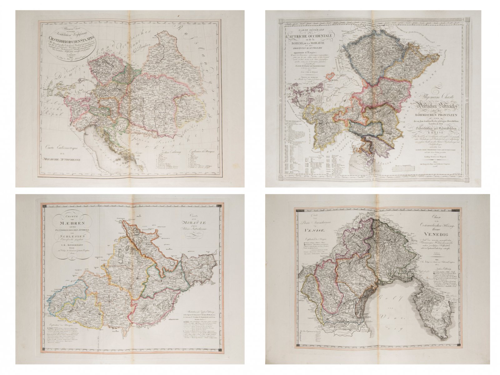
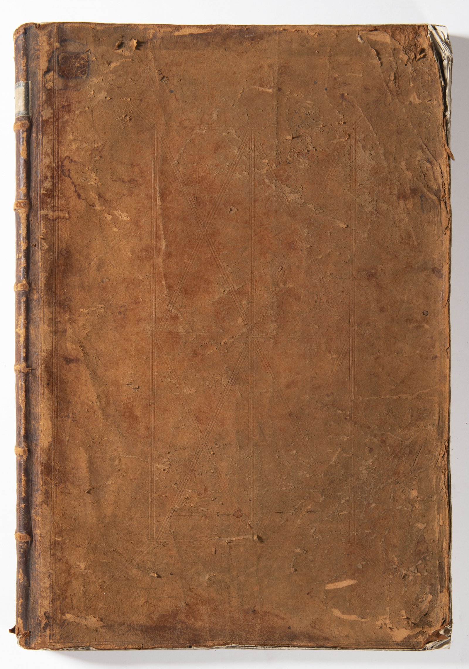
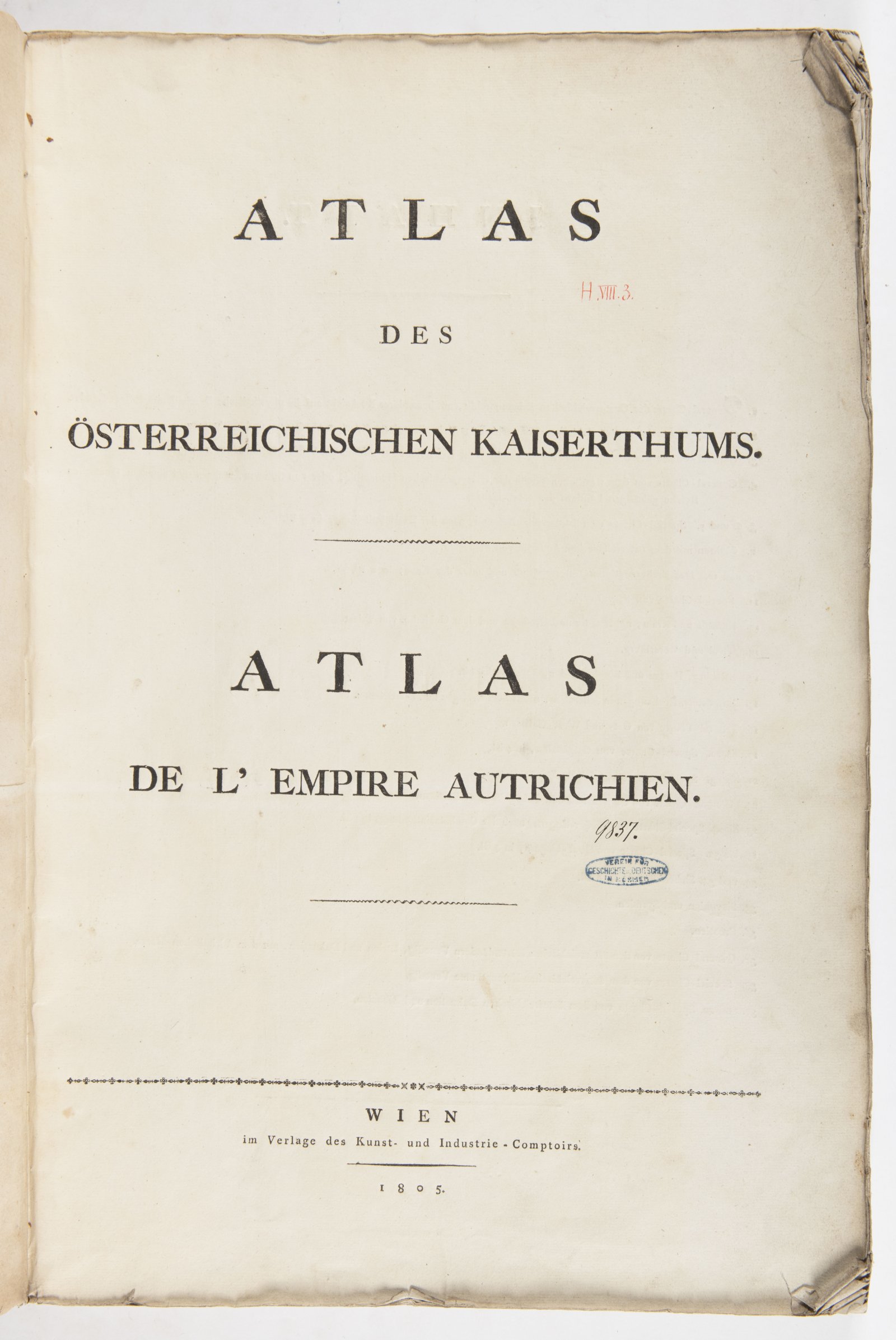
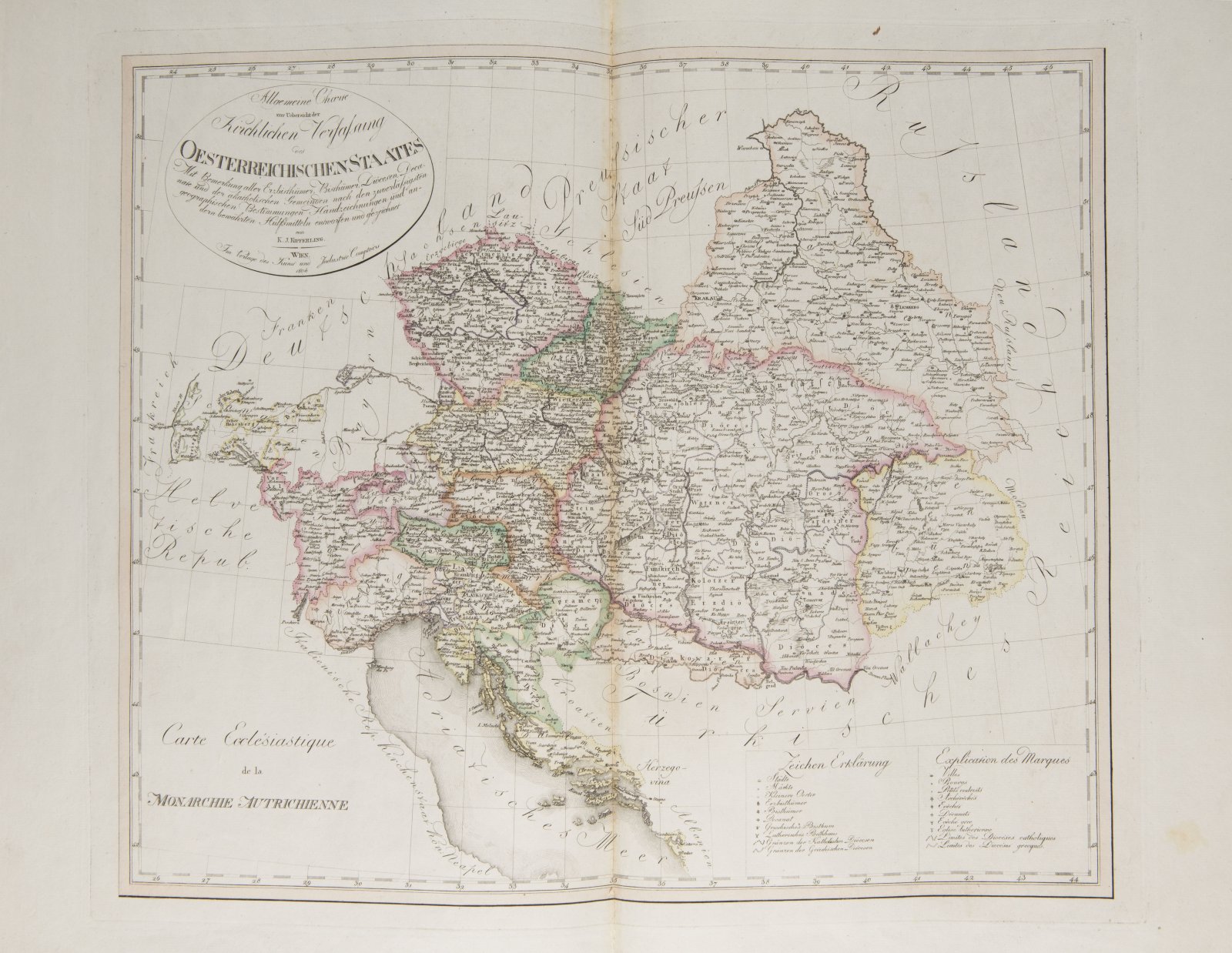
ATLAS OF THE AUSTRIAN EMPIRE
1805
full leather binding
59 x 41 x 3 cm (h x w x d)
Starting price
Price realized
30 000 CZK
| 1 250 €
| 1 250 €
price without premium
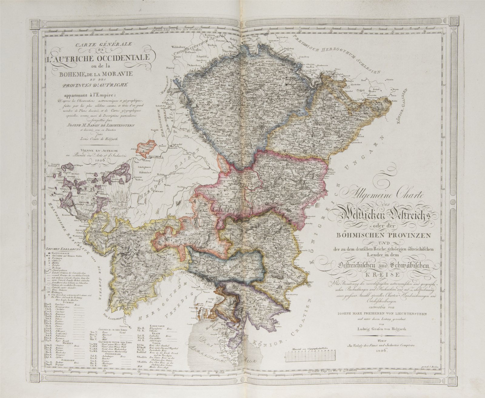
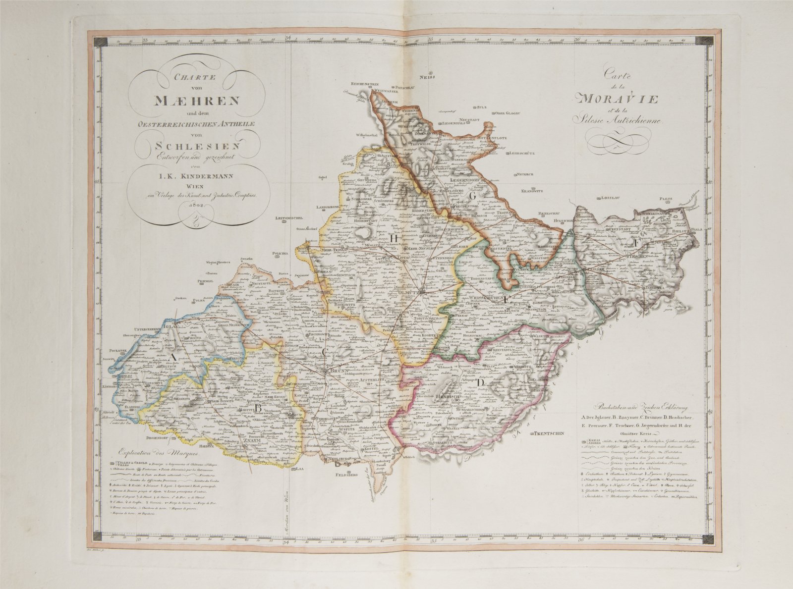
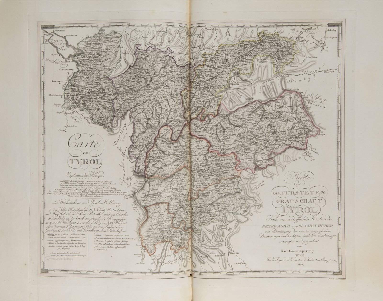
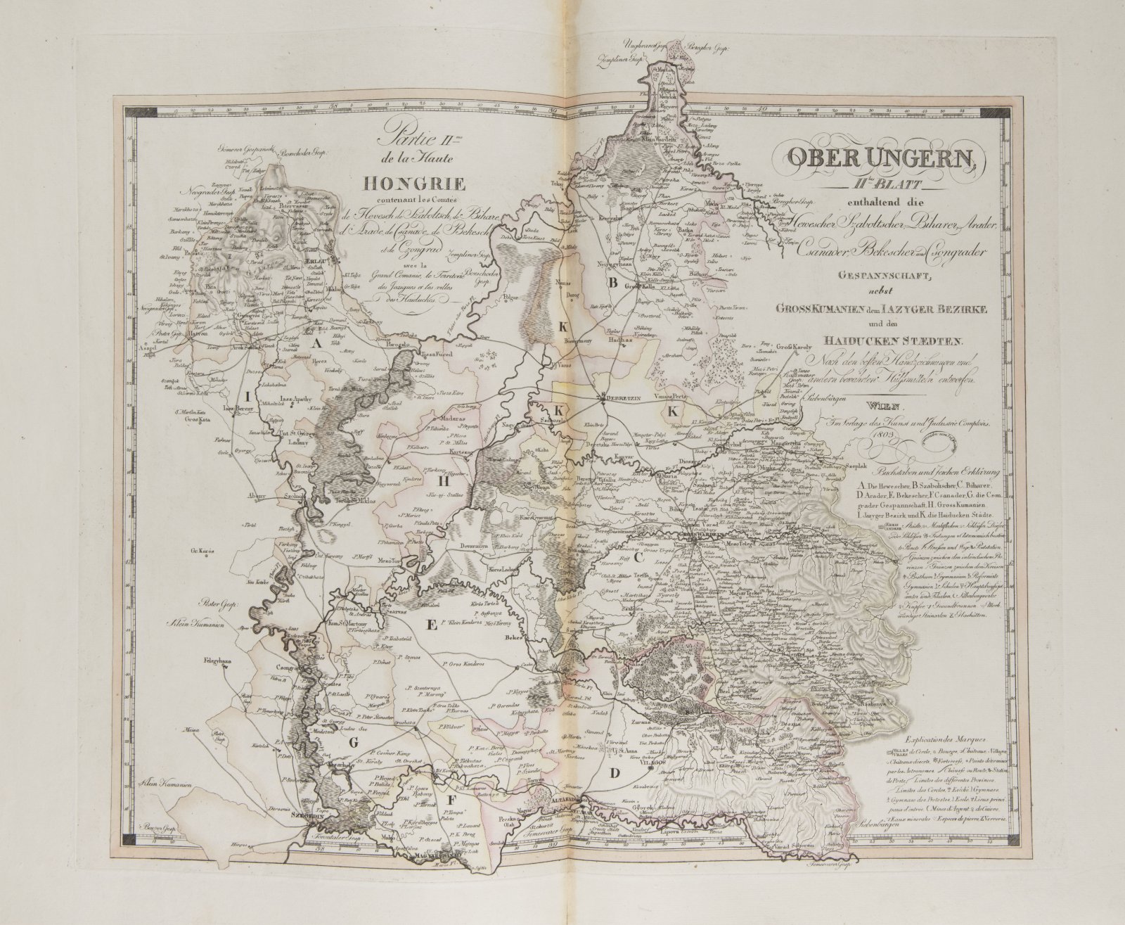
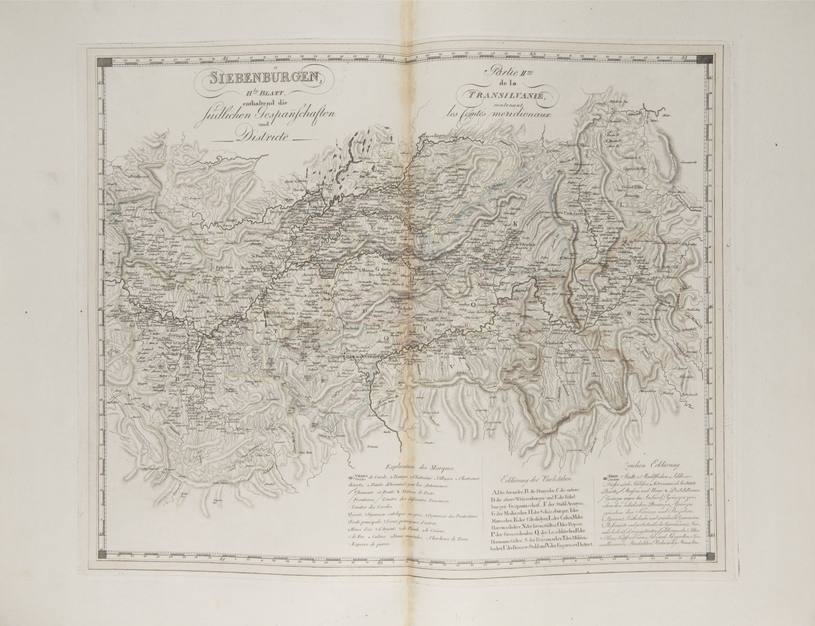
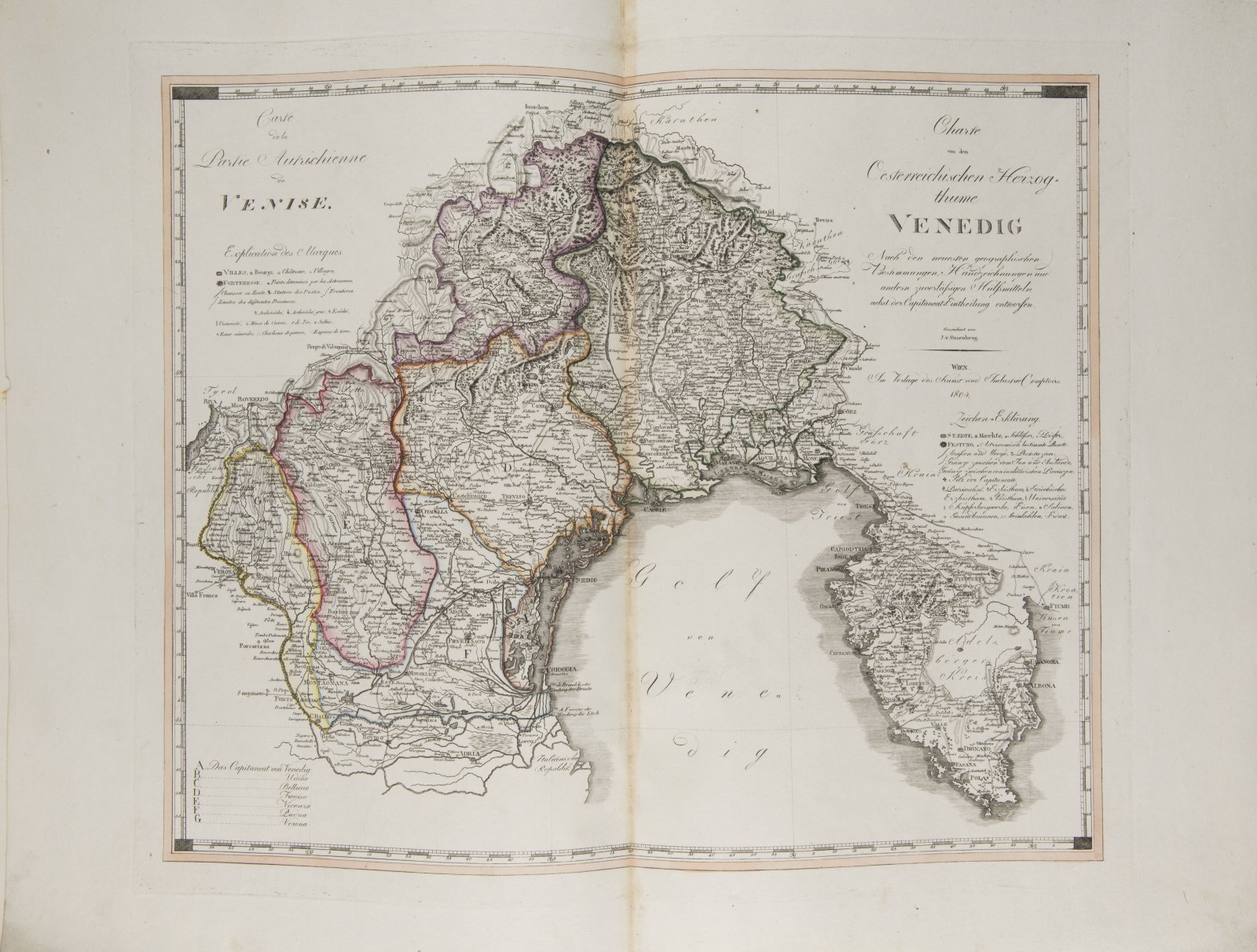
The German-French Geographical Atlas consists of forty old colored two-sheet copperplate maps, paper size 59 x 76 cm, arranged according to content at the front. These are detailed topographical maps of individual historical countries and territories of the Austrian Empire. Three maps are dedicated to Bohemia and one to Moravia. The maps have an elevation chart shown using the scoop method, simple framing, bilingual lettering in the title and legend, some are marked with the names of the authors and engravers (K. J. Kipferling, I. K. Kindermann, K. Timlich), some are dated 1803, 1804, 1805. Watercolor line and surface coloring is done in subtle tones. A well-preserved clean copy with wide leaf margins with only book block corners bent. Full leather flexible period worn binding on 6 genuine bindings with worn blindfold frame on both sides.
More works from auction

NECKLACE - AWARD OF MEDA MLÁDKOVÁ
Starting price35 000 CZK | 1 458 €
Price realized
35 000 CZK | 1 458 €

Lot 1 SAINT PAUL
Starting price100 000 CZK | 4 167 €

Lot 2 COUNCIL OF CONSTANCE CHRONICLES
Starting price90 000 CZK | 3 750 €
Price realized
90 000 CZK | 3 750 €

Lot 3 CRITICISM OF HUSSITISM
Starting price18 000 CZK | 750 €

Lot 4 COMPENDIUM OF CHRISTIAN DOCTRINE
Starting price48 000 CZK | 2 000 €

Lot 5 PJSNE DUCHOWNJ EWANGELISTSKÉ Z PJSEM SWATÝCH
Starting price38 000 CZK | 1 583 €
Price realized
50 000 CZK | 2 083 €

Lot 6 RENAISSANCE VIEW OF PRAGUE
Starting price5 000 CZK | 208 €
Price realized
9 500 CZK | 396 €

Lot 7 EMPEROR PALACE IN PRAGUE
Starting price6 000 CZK | 250 €
Price realized
8 500 CZK | 354 €
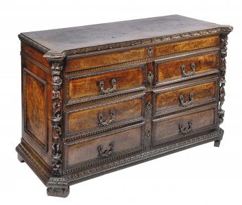
Lot 8 MANNERIST CHEST OF DRAWERS "A BAMBOCCI"
Starting price95 000 CZK | 3 958 €
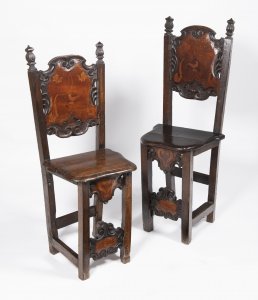
Lot 9 PAIR OF MANNERIST CHAIRS
Starting price15 000 CZK | 625 €
Price realized
33 000 CZK | 1 375 €
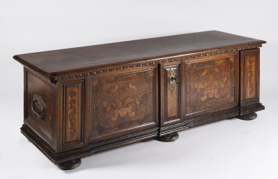
Lot 10 BAROQUE CHEST
Starting price60 000 CZK | 2 500 €

Lot 11 BAROQUE POCKET WATCH
Starting price80 000 CZK | 3 333 €